Walkable cities are built on foundational principles of connectivity, density, mixed-use development, pedestrian safety, accessibility, and vibrant public spaces. Urban designers integrate these principles using evidence-based strategies and digital tools like D5 Render’s City Generator to simulate, evaluate, and communicate urban environments before they’re built.
Key Takeaways
- Walkable cities rely on strong street connections, mixed-use neighborhoods, safe pedestrian spaces, and lively public areas to make walking easy and enjoyable.
- Designing streets at a human scale with wide sidewalks, trees, and safety features encourages people to walk more and feel secure.
- Digital tools like D5 Render’s City Generator let planners create realistic 3D models to test and show walkable city designs before building.
- Combining smart urban design with supportive policies and community involvement leads to healthier, more vibrant, and sustainable cities.
1. Walkable City Principles
Urban planners and designers rely on a set of foundational principles to shape a walkable city. These principles draw from frameworks such as the 'five Ds'—density, diversity, design, destination accessibility, and distance to transit—and Jeff Speck’s four pillars: safe, useful, comfortable, and interesting. Together, these concepts guide the transformation of urban environments into places where walking is practical, enjoyable, and safe.
1.1 Connectivity
Efficient street networks with high intersection density reduce travel distances and support multimodal mobility. Well-connected grids increase pedestrian activity by linking neighborhoods, jobs, and services. Real-world examples (e.g., Buffalo, NY) show that both physical and visual connectivity promote walkability and improve access to healthcare, work, and social interaction.
1.2 Mixed-Use and Density
Combining residential, commercial, and recreational uses within pedestrian shed promotes foot traffic and supports local economies. Higher density (e.g., >20 dwellings/hectare) lowers transportation costs and improves access to services. Zoning reforms in cities like Portland and New York have facilitated these patterns, encouraging compact, car-independent living.
1.3 Human Scale and Safety
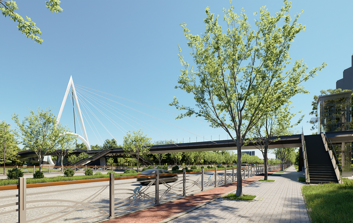
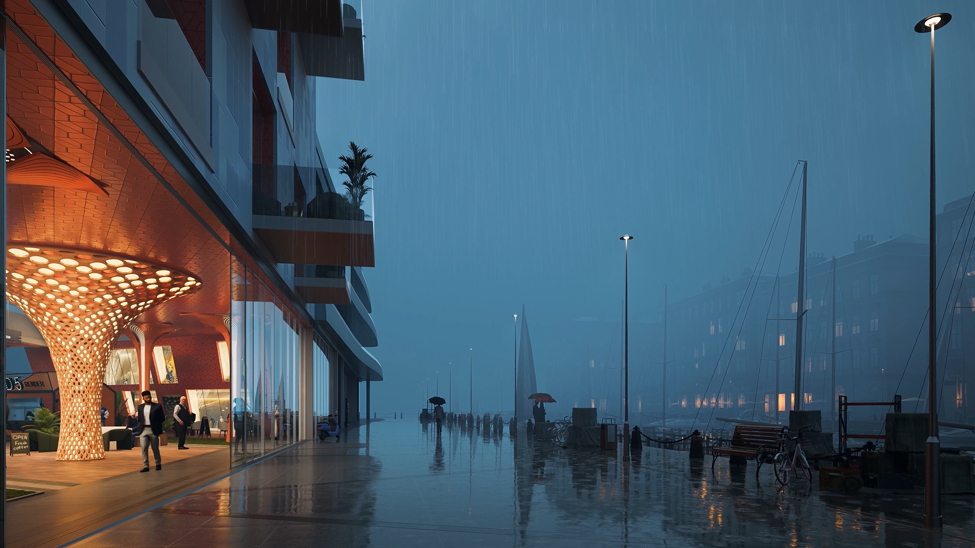
Designing for pedestrians involves wide sidewalks, street trees, pedestrian lighting, and traffic separation. Safety features reduce accidents and foster comfort. Cities such as Copenhagen and New York have shown that reallocating road space to pedestrians (e.g., Times Square) leads to safer, more active urban streets.
| Design Feature | Description and Safety Benefit |
|---|---|
| Wide Sidewalks | Provide space and comfort, separating pedestrians from vehicles. |
| Street Trees | Offer shade and a buffer from traffic, slowing vehicle speeds. |
| Human-scale Lighting | Increases visibility and safety at night. |
| Seating and Awnings | Encourage people to linger and socialize, enhancing street vitality. |
| Clear Walkways | Remove obstacles, ensuring accessibility for all users. |
| Integration with Transit | Keeps bus shelters and stops accessible without blocking pedestrian flow. |
| Separation from Traffic | Physical barriers or buffers reduce conflicts between vehicles and pedestrians. |
1.4 Public Spaces
Public spaces serve as social and recreational nodes. Examples like the High Line (NYC) or Tom Lee Park (Memphis) demonstrate the value of investing in inclusive, accessible third places that enhance quality of life and local economic activity.
2. Multiscale Urban Design Strategies
2.1 City Scale
At the macro level, planners integrate green corridors and public transit to encourage active transport. Projects like the Atlanta BeltLine use existing infrastructure to create loops of trails and parks, supporting sustainable mobility and reducing reliance on cars.
2.2 Neighborhood Scale
At the neighbourhood scale, strategies focus on block size, mixed-use development, and proximity to daily needs. Smaller blocks and a fine-grained street grid make it easier to walk between destinations. The 15-minute city concept, which aims for all essential services within a short walk or bike ride, has influenced neighbourhood planning in North America. Kirkland, Washington, developed a 10-Minute Neighborhood Analysis tool to guide its comprehensive plan, helping residents access shops, schools, and parks quickly.
2.3 Street Design
Street design prioritizes pedestrian comfort and safety. Key elements include wide footpaths, frequent crossings, street trees, and traffic calming measures. Features such as protected bike lanes, curb extensions, and pedestrian islands reduce vehicle speeds and create safer environments. U.S. cities like Madison and Minneapolis have adopted Complete Streets policies, leading to safer, more vibrant streets. These policies encourage consistent application of pedestrian-first principles, supported by data-driven approaches and community engagement. D5 Render’s City Generator enables detailed modeling of street layouts, helping teams visualize improvements and communicate ideas to stakeholders.

3. Using D5 City Generator to Visualize Urban Planning
3.1 Why use D5 for this
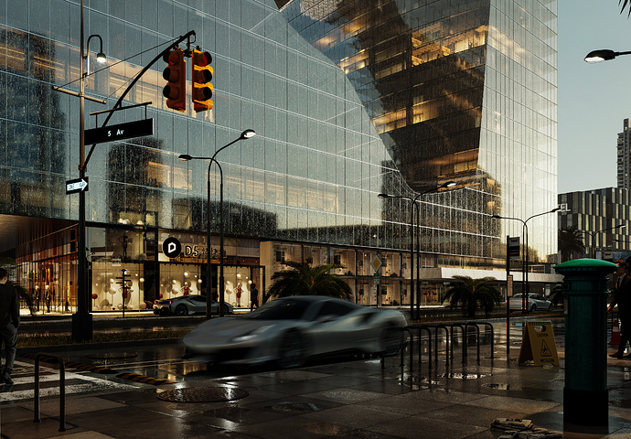
You can transform a walkable city concept into a clear, engaging vision with D5 Render. D5 Render’s City Generator allows planners to convert OpenStreetMap (OSM) or Shapefile data into accurate 3D urban models. This bridges design and communication, enabling scenario testing and visual validation before construction.
D5 City Generator answers the question: What does a walkable city look like before it gets built?
3.3 Step-by-Step Workflow Using OSM and City Generator
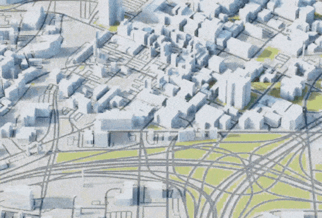
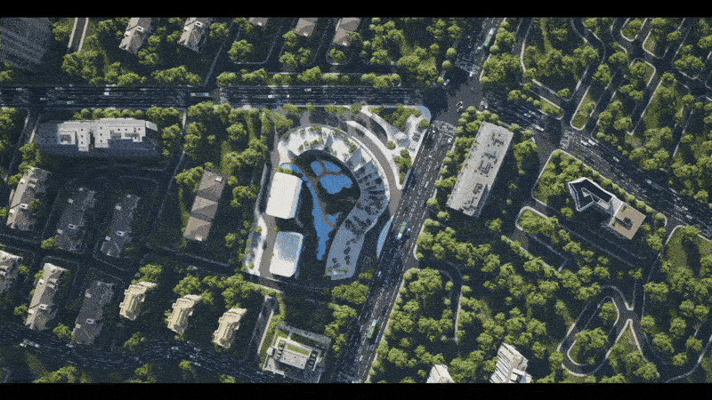
Use D5 Render’s City Generator to create accurate 3D city models based on OpenStreetMap (OSM) or Shapefiles. Select a real-world location, import road and building data, and adjust parameters like height, color, and materials.

Steps:
- Open the Terrain menu in D5 Render, click City
- Choose your target area.
- Import OSM or Shapefile data.
- Adjust building settings.
- Preview and refine the model.
This provides a fast, realistic base for visualizing walkable city plans. You can select any area on the map and turn it into a 3D model with just a few clicks. This tool helps you save time and ensures your walkable city design matches real-world locations.
Also read: D5 Urban Planning Software for 3D City Creation
3.4 Preparing 3D City Models
Focus your modeling on areas visible in-camera. Use D5's Brush tool to add trees and vegetation efficiently with layering and randomness. Reuse assets to reduce file size. Animate people and vehicles to simulate activity and improve scene realism. Manage large scenes filled with detailed assetslike trees, people, and street elements. Too many details can slow down your computer. Use the Brush tool in D5 Render to paint vegetation with randomness and layering. This makes your cityscape look more natural and lively.
When you prepare your 3D model, focus on the areas that matter most for your walkable city. Limit extra details outside the camera view. Reuse models from the asset library to save time and keep your scene efficient. Set up animation paths for people and vehicles, adjusting their density and speed to create a lively, walkable environment.
3.5 Customizing Urban Assets
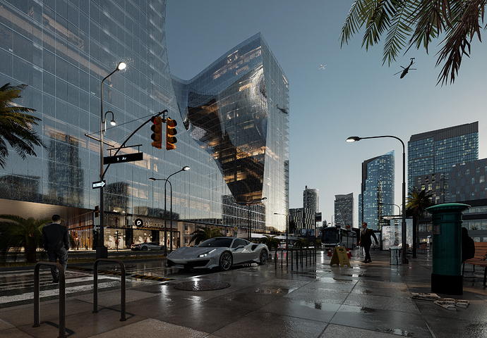
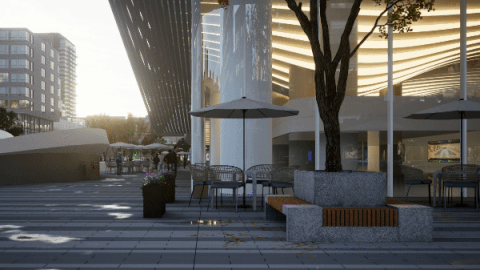
Use D5’s Asset Library to place essential urban elements like sidewalks, benches, bus stops, and street lighting. These improve pedestrian flow, safety, and usability. Add decals such as crosswalks or signs for clarity and realism.
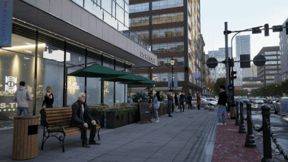
Focus on activating ground floors with visible commercial fronts like cafes or retail. Research shows this attracts more foot traffic and supports street life.
Sidewalks are critical to walkability. Studies confirm they improve safety and encourage walking. You can also use one-way systems and signs to balance traffic and enhance flow.
For realism, use additional street furniture, outdoor seating, and functional details like traffic signs and decals. These assets help communicate your design clearly and make the model more engaging for stakeholders.


Also read: Quicker, Easier Animation Rendering for Commercial Streets with New D5 Assets
4. Immersive Walkthroughs and Communication
4.1 Experiencing Walkability in First Person
D5 Render's first-person mode and path animation tools let you explore your walkable city from the pedestrian‘s perspective. Simulate natural movement through plazas, sidewalks, or bike lanes. This interactive experience helps stakeholders understand how people will navigate and feel within your design.
Animating people, vehicles, and street life adds realism and boosts engagement. These walkthroughs make presentations more persuasive and have been shown to improve client approval rates and reduce miscommunication.
4.2 Eye-Level Camera Work
Use camera angles at eye level to emphasize human-scale elements like wide sidewalks, active frontages, and safe crossings. Walkthroughs can showcase how spaces connect'such as plazas flowing into parks or shops lining a transit corridor. Adding subtle animations like people using benches or waiting at bus stops reinforces usability.
Overlays or visual callouts can highlight sustainable features like green roofs, permeable pavements, or solar lighting, making benefits more obvious to non-design stakeholders.
4.3 Exporting for Impactful Presentations
To communicate clearly, export a mix of rendered stills, videos, and live walkthroughs. Use:
- Keyframe animations for smooth camera flows
- HDRI skies and atmospheric effects for mood and realism
- D5’s AI tools for faster lighting and texture setup
These outputs help clients and collaborators quickly grasp your vision and provide feedback, streamlining approvals and encouraging confident decisions.
Bottom line: Immersive visuals build empathy and trust—two essentials for gaining buy-in on walkable city plans.
5. Conclusion
Walkable cities don’t emerge by accident. They’re planned using clear principles and supported by technical workflows and tools. D5 Render’s City Generator enables planners to test design options in realistic 3D environments, helping align urban design with community needs, policy goals, and sustainability standards.
6. FAQ
6.1 What defines a walkable city?
A walkable city features connected streets, mixed-use neighborhoods, safe pedestrian infrastructure, and vibrant public spaces. These elements encourage people to walk for daily needs, improving health and community life.
6.2 What role do digital tools play in walkable city planning?
Digital tools, such as D5 Render’s City Generator, allow planners to create detailed 3D models. These models help teams visualize changes, test scenarios, and communicate ideas to stakeholders before construction begins.
6.3 What is the impact of zoning reform on walkability?
Zoning reform removes barriers to mixed-use and higher-density development. Cities that update zoning codes enable more housing options, reduce parking requirements, and support neighborhoods where people can walk to shops, schools, and parks.
6.4 What makes public spaces important in walkable cities?
Public spaces provide areas for recreation, social interaction, and community events. Well-designed parks and plazas attract foot traffic, support local businesses, and foster a sense of belonging among residents.
6.5 What are Complete Streets policies?
Complete Streets policies require cities to design roads for all users, including pedestrians, cyclists, and transit riders. These policies improve safety, accessibility, and comfort, making walking a practical choice for everyone.