The world of GIS tools is evolving fast, and by 2025, 3D visualization will be more powerful than ever. Imagine transforming raw geospatial data into cinematic 3D experiences—whether for urban planning, environmental analysis, or interactive simulations. From D5 Render's photorealistic magic to Unreal Engine's immersive worlds, today's tools blend scientific precision with stunning visuals. No more boring maps—just next-level storytelling that captivates stakeholders and accelerates decisions. Ready to discover the top 5 workflows reshaping GIS? Let's explore how these game-changers turn complex data into visual masterpieces.
Key Takeaways: Top 5 GIS Workflows for 2025
- Cesium + Unreal Engine 5 – Interactive simulations with real-time geospatial data streaming for defense, gaming, and training.
- Cesium + D5 Render – Photorealistic 3D GIS storytelling in minutes, perfect for urban planning and large-scale architectural projects.
- Blender + QGIS – Artistic freedom meets GIS precision for terrain sculpting and procedural 3D modeling.
- ArcGIS Pro + CityEngine – Advanced urban planning with procedural street networks and AI-driven rule-based design.
- Google 3D Tiles + Mapbox – Cloud-based, lightweight photorealistic 3D cities for web and mobile apps.

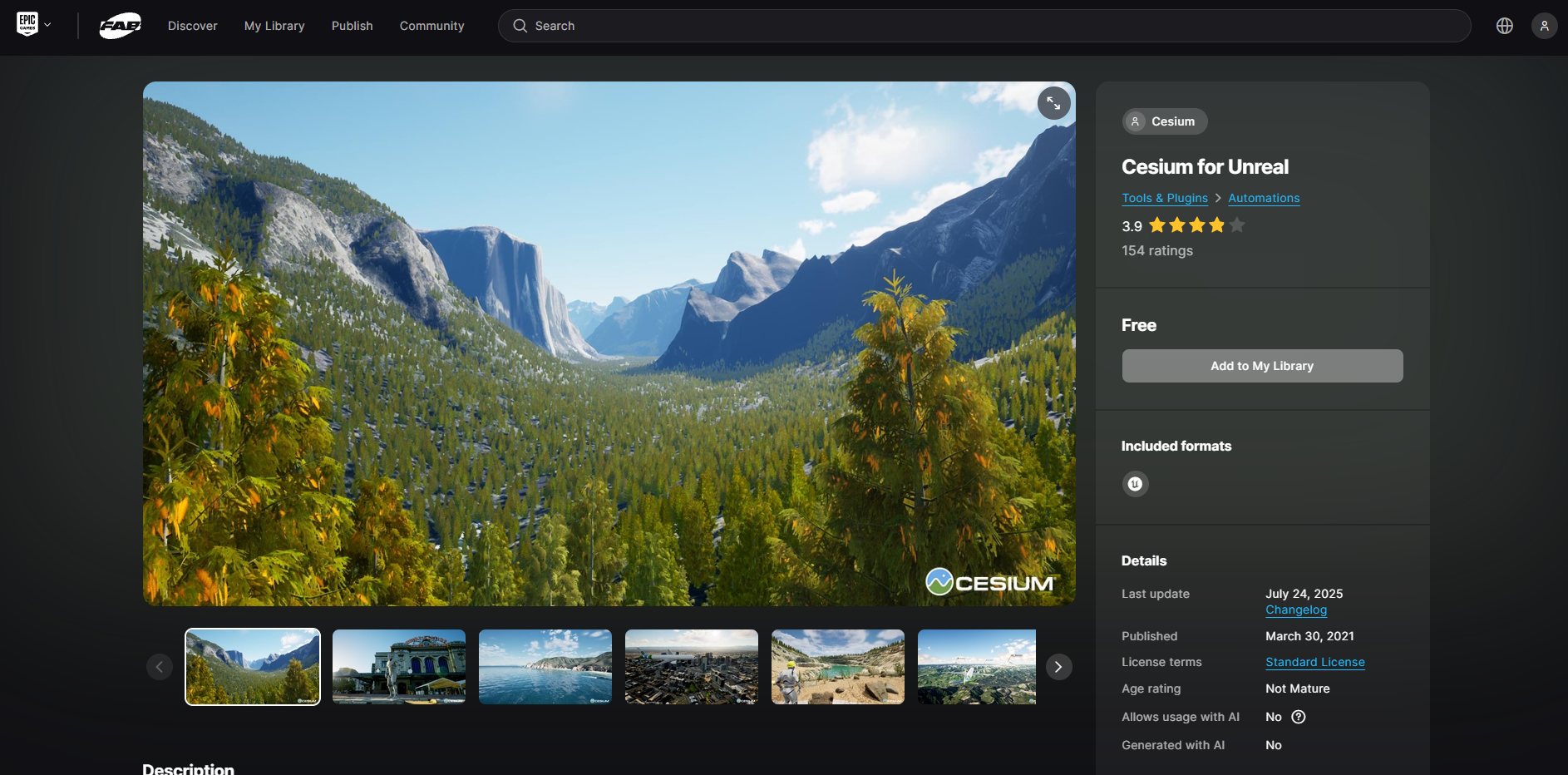
1. Cesium for Unreal Engine 5 – For Interactive Simulations
Want to level up your 3D visualization with interactivity? Cesium for Unreal Engine 5 (UE5) is the way to go. This combo lets you build realistic, interactive 3D worlds for simulations, training, and virtual experiences, all powered by real-world geospatial data.
Using Cesium's detailed 3D tiles and UE5's Nanite geometry with Lumen lighting, you can create dynamic terrains, cityscapes, or disaster scenarios. Plus, Unreal Engine's Blueprints system makes it easy to add interactions—like drone flights or traffic flows—without heavy coding.
Industries from defense to gaming are using this for immersive geospatial storytelling. Ready to go beyond static maps and dive into interactive 3D visualization? Cesium for UE5 is your ticket. ?
2. Cesium + D5 Render – Your Visual Powerhouse
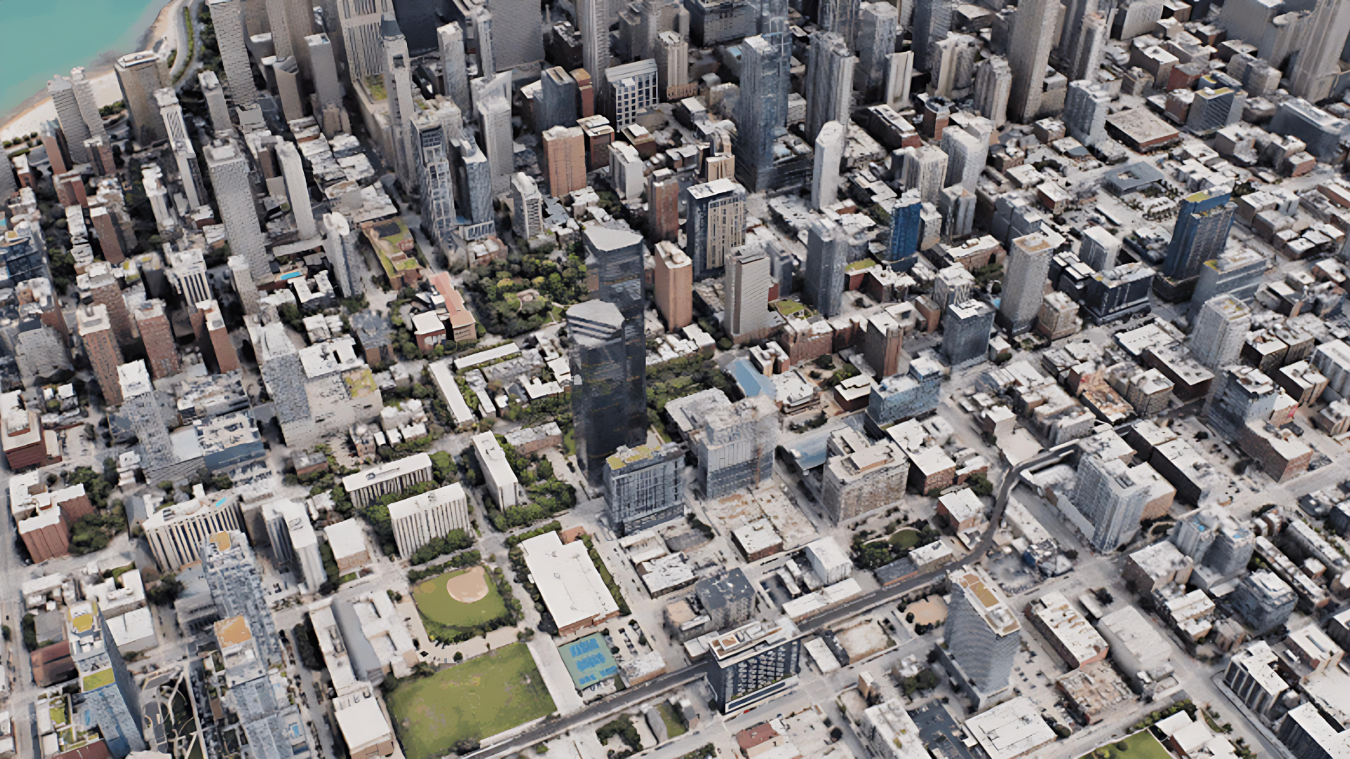
When precision meets storytelling magic, you get the ultimate 3D GIS duo: Cesium + D5 Render (a real-time 3D visualization tool). Cesium delivers accurate geospatial data—think real-world terrain, BIM models, and live sensor feeds—while D5 Render transforms it into photorealistic visuals.
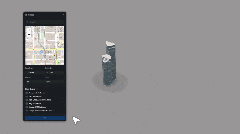
Master Cesium in D5: Follow These 3 Simple Steps
2.1 Why This Workflow Stands Out?
Cesium's Geospatial Precision :
- Delivers millimeter-accurate terrain modeling, real-time BIM integrations, and live IoT sensor data for scientific and planning applications.
- Ideal for urban development, defense simulations, and environmental analysis, where exact geographic fidelity is non-negotiable.
D5 Render's Visual Storytelling :
- Transforms technical datasets into striking, Hollywood-grade visuals—complete with dynamic lighting, weather effects, and lifelike textures—without compromising accuracy.
- Moves beyond static reports into engaging 3D visualization, making complex data instantly digestible for stakeholders.
Together, they solve a critical gap: Cesium grounds your work in reality; D5 Render makes that reality unforgettable. Whether you're planning urban infrastructure or crafting immersive 3D GIS simulations, this combo ensures your visuals are as precise as they are powerful.

2.2 The Real-World Impact: Faster Decisions, Clearer Insights
For urban planners, environmental analysts, and architects, the Cesium-D5 workflow offers a game-changing advantage:
- Real-time geospatial data streams (terrain, BIM, IoT) meet dazzling visual fidelity, reducing ambiguity in presentations.
- Faster approvals—stakeholders grasp spatial relationships intuitively, reducing back-and-forth revisions.
- Enhanced public engagement—no more dry technical reports, just immersive 3D experiences that drive consensus.
While UE5 shines for complex simulations, many designers prefer D5 Render + Cesium for rapid, no-code visualization, here's why smart teams are bypassing Unreal Engine for the D5 + Cesium combo:
- One-Click to Production Ready : Where UE5 requires days of material tweaking, D5 delivers broadcast-ready visuals in one session - its AI-powered presets auto-optimize Cesium data into cinematic assets complete with perfect PBR textures and atmospheric effects.
- Real-Time Visualization Power : Unlike UE5's complex Sequencer, D5 Render 's real-time editing allows planners to instantly toggle seasons, climate conditions, and lighting effects on Cesium-fed 3D models - all while maintaining photorealistic 4K output. This instant feedback loop transforms environmental impact studies from weeks to hours.
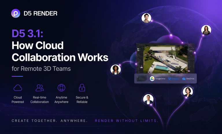
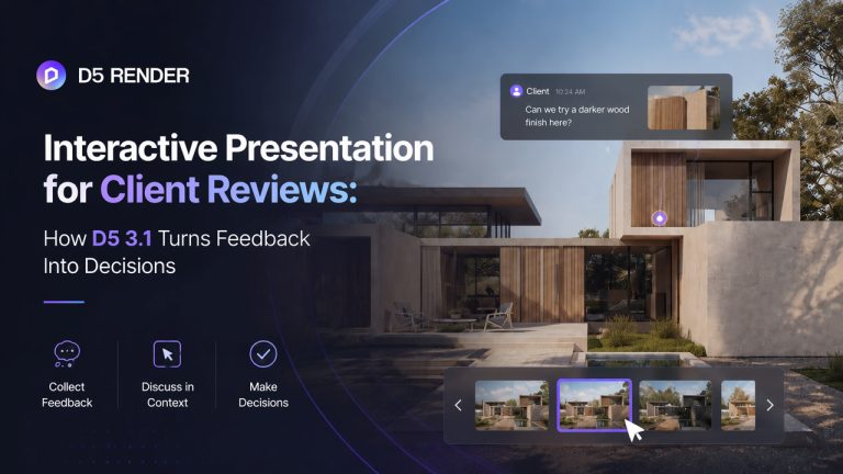
- Client-Friendly Collaboration : Stakeholders can comment directly within D5 Render's Showreal virtual tours—supporting text, images, and location pins—eliminating the hassle of EXE file exchanges. This cloud-based review system revolutionizes public sector approvals where participants often lack Unreal Engine expertise.
Best of all, integration is effortless. Simply connect your Cesium account to instantly stream live 3D data into D5's AI-powered rendering environment. Want to see how quickly you can transform raw geodata into stunning presentations? Our step-by-step guide shows you.
Explore D5 Render 2.11 Teams: What's New
3. Blender + QGIS: Where Geospatial Meets Art
For creatives exploring 3D GIS geospatial data, the Blender + QGIS combo is revolutionizing 3D visualization. This powerful pairing blends GIS precision with 3D modeling freedom seamlessly.
Why it's a game-changer:
- QGIS (a flagship GIS tool) handles geospatial heavy lifting—importing DEMs (digital elevation models), LiDAR scans, and satellite imagery with pinpoint accuracy.
- BlenderGIS add-on effortlessly brings this data into Blender's 3D workspace.
In Blender, 3D GIS possibilities are endless:
- Sculpt realistic terrain with dynamic brushes.
- Paint authentic ground textures using real-world satellite imagery.
- Generate procedural buildings with geometry nodes.
- Render cinematic flythrough for 3D visualization projects.
✅ Pro Tip : Boost your Blender workflow with D5 Render ! Enjoy seamless integration, AI-powered post-processing, and a free, extensive material library for stunning renders.
Get Instant Access: D5 + Blender Workflow https://www.youtube.com/embed/Cv5wi5P5d7M
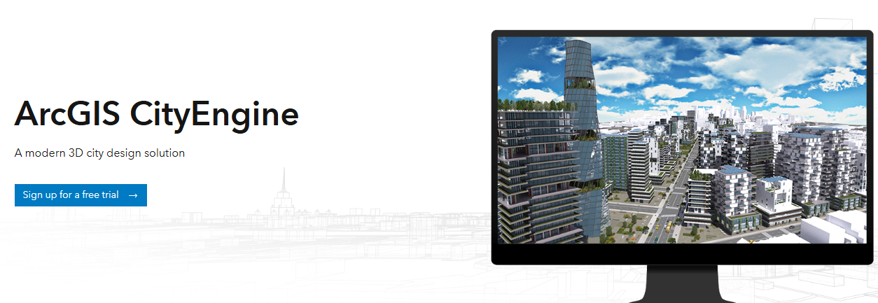
4. ArcGIS Pro + CityEngine (Advanced Urban Planning Integration)
For urban planning professionals and smart city initiatives, the combination of ArcGIS Pro and CityEngine delivers unparalleled 3D GIS capabilities. ArcGIS Pro offers industry-standard spatial analysis tools, while CityEngine's procedural modeling generates high-fidelity 3D urban environments from GIS data.
The 2025 release of CityEngine introduces significant updates, notably the new Street Designer tool, which enables the procedural creation of complex, multimodal street networks and enhances 3D modeling for infrastructure planning. It also improves workflow integration between GIS data and 3D visualization.
The system supports manual rule-based urban layout optimization through its CGA rules, facilitates data-driven planning decisions by leveraging GIS data, and aids in environmental and infrastructure assessments through detailed 3D visualizations. Cities around the world utilize this integrated platform for data-informed urban development, and the system continues to evolve with new computational planning features, such as refinements in CGA support and productivity enhancements in the Visual CGA Editor.
5. Google Photorealistic 3D Tiles + Mapbox – Cloud-Based, Lightweight Workflow
Looking for a fast, web-friendly solution for high-quality 3D visualization in geospatial projects? Google Photorealistic 3D Tiles offer a cloud-based solution that delivers stunning, real-world 3D landscapes without heavy local processing.
These tiles provide ultra-detailed photorealistic models captured from aerial imagery, compatible with 3D Tiles renderers like CesiumJS. Mapbox , on the other hand, offers powerful SDKs for smooth rendering and interaction in web and mobile apps, including its own 3D mapping capabilities through the Mapbox Standard style. This allows for streaming high-fidelity 3D data on demand, with benefits such as low hardware dependency and global scalability. For architects, urban planners, and developers, Google Photorealistic 3D Tiles can be invaluable for creating professional-grade 3D visualizations.

6. Conclusion on GIS Tools for Next-Level 3D Visualization
By 2025, GIS and 3D visualization are no longer just about accuracy—they're about telling powerful stories. Tools like Cesium + D5 Render lead the pack, blending geospatial precision with Hollywood-worthy realism, while others like Blender + QGIS and Unreal Engine integrations push creative limits. Whether you're planning cities or visualizing environmental data, these workflows turn raw data into breathtaking insights. Ready to take your maps to the next dimension? Dive in—the future of 3D visualization in GIS is here. ?
Continue Reading: More Blogs About 3D Visualization
Rayinglab Secrets: Next-Gen Architectural Visualization >
User Showcase: Archicad Interior Visualization with D5 >
KPF & D5 Render Webinar: Master Architectural Visualization >
How D5 Render's real-time ray tracing rendering benefits our company >
Architectural Visualization Turkey: Reta Proje Case Study >
How to Effectively Communicate Parametric Architecture through Visualization >